Map Projection Blog – Flattening the Earth
MapRef.org by Dr. Stefan A. Voser
MapRef Shop
MapRef.org Design & Art Shop |
Gadgets and more for Geodesists, Gartographers, Geographers, Geomatists and MApLovers … |
Design: MAp Projections, Maps, Geometry and more |
by Mapref.org

thank you for contacting mapref.org
thanks for contacting mapref.org
you will receive a confirmation email
if you didn’t receive a confirmation email, please check also your spam folder
be patient for getting an answer [read more]
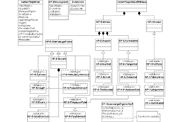
Data Modelling of Map Projections
Data Modelling of Map Projections
Dr. Stefan A. Voser, MapRef.org